Operates Geographic Information Systems (GIS) to map and analyze environmental sustainability, resource access, public health risks, land-use patterns, and other location-based topics.
– Oklahoma Tornado Vulnerability Map
(Created 5/1/26)
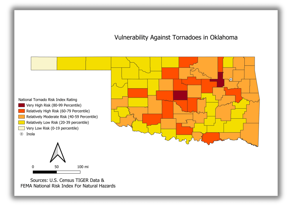
Visualized county-level tornado vulnerability across Oklahoma using FEMA National Risk Index percentile ratings. Inola, OK is included as a reference point because of its location near a planned aluminum smelter, where severe tornado damage could create additional environmental and public safety concerns for nearby residents.
– Tennessee Environmental Burden and Housing Age Hotspot Analysis
(Created 3/29/26)
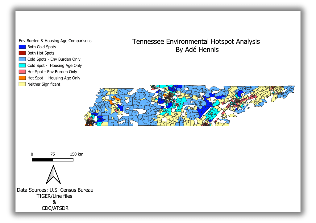
Cross-analyzed environmental burden and housing age across Tennessee census tracts. Identified areas where environmental vulnerability and older housing patterns overlap, including shared hot spots, shared cold spots, and areas where only one factor is significant.
– McLennan County Recommended POD Site Analysis
(Created 3/19/26)
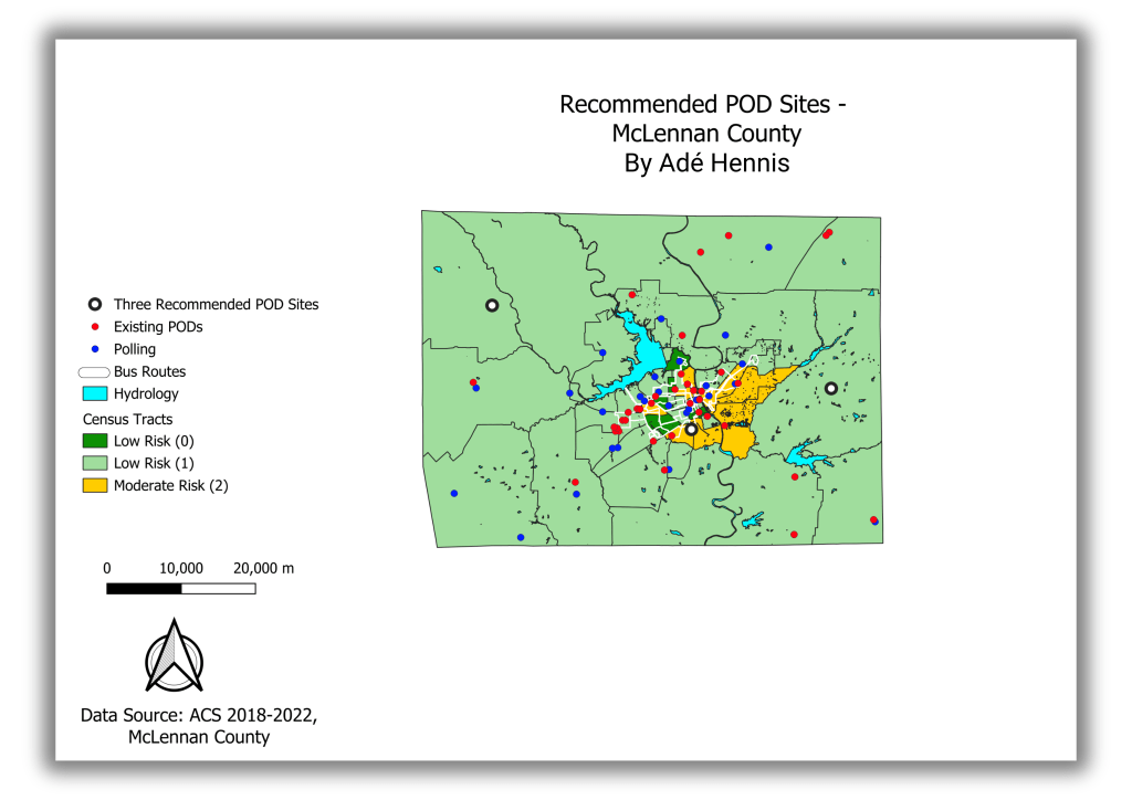
Recommended three Points of Dispensing (POD) sites in McLennan County, Texas. PODs are locations where people can receive medicine, vaccines, or supplies during a public health crisis. The sites were recommended by comparing existing PODs, polling locations, transportation routes, census tract risk levels, and geographic barriers like waterways to identify underserved areas.
– Western U.S. Greater Sage-Grouse Habitat and Federal Land Ownership
(Created 1/30/26)
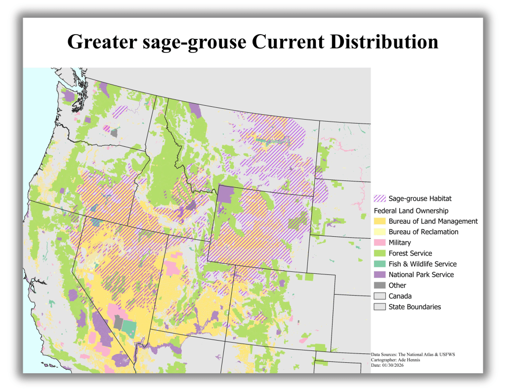
Highlighted the relationship between wildlife habitat and federal land management by showing where greater sage-grouse bird habitats overlap with federally owned land across the western United States. This helps identify which public agencies may play a role in habitat protection, land-use decisions, and conservation planning.
